
Validating the July 2020 Bagmati Flood: Linking Rainfall to Inundation Using Satellite Data
Published in Technical Research Note, 2026
Introduction
Floods in the Himalayan region are often sudden, destructive, and difficult to predict. In river basins like the Bagmati, where steep terrain meets densely populated floodplains, even a short period of intense rainfall can trigger widespread inundation.
One of the biggest challenges in such regions is the lack of dense ground-based observations. This study uses satellite data to answer a critical question: How long does it take for rainfall to turn into flooding?
In this study, I use satellite data to answer that question for the July 2020 flood event in the Bagmati Basin. By combining precipitation data from GPM with flood observations from Sentinel-1 SAR, I estimate both the timing (hydrological lag) and the triggering conditions of the flood.
1. Understanding the Basin: Why Bagmati is Flood-Prone
The Bagmati River Basin spans from the mountainous regions in the north to low-lying plains in the south. This variation in topography plays a major role in flood dynamics.
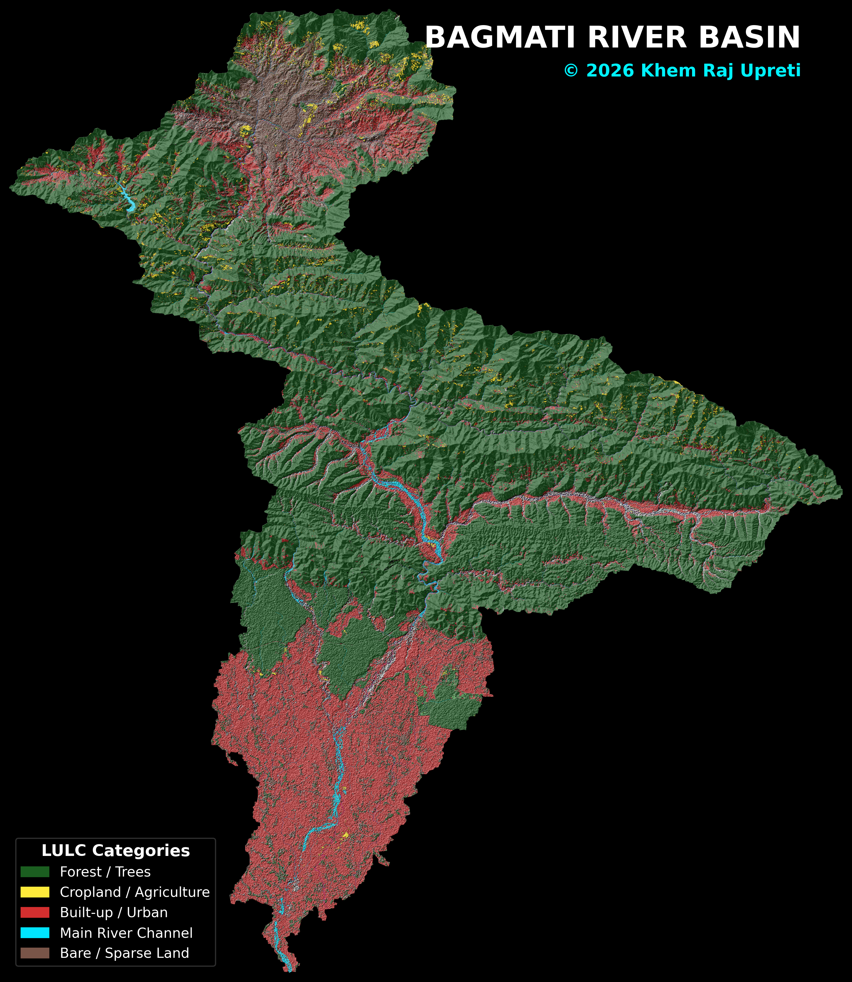 Figure 1: Land Use and Land Cover (LULC) of the Bagmati Basin. Forested areas dominate the upper catchment, while agricultural and urban regions are concentrated downstream. © 2026 Khem Raj Upreti
2. The Trigger: Extreme Monsoon Rainfall
Using satellite-based rainfall data (GPM IMERG V07), I analyzed precipitation patterns during the 2020 monsoon.
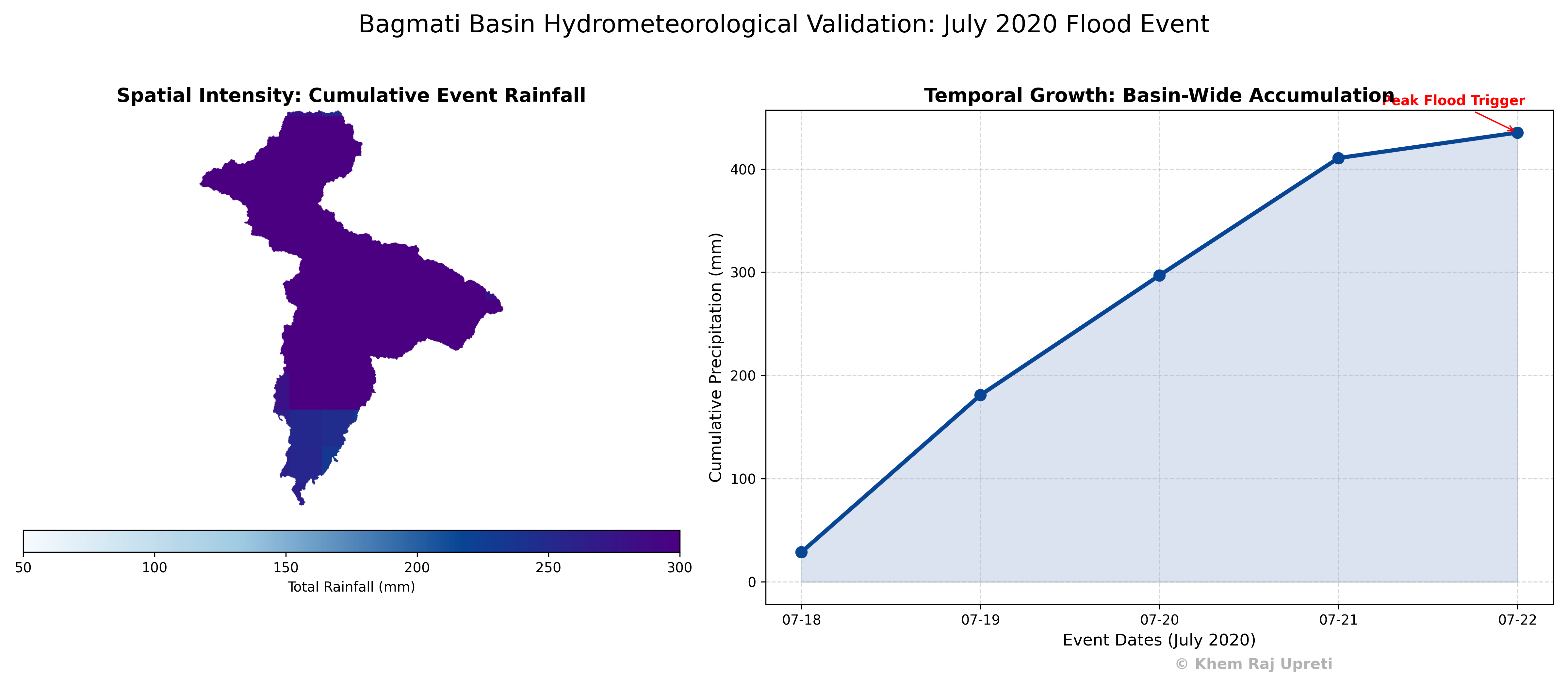 Figure 2: Cumulative rainfall during July 2020. A sharp increase around July 20–22 indicates an extreme monsoon rainfall event across the basin. Data: GPM IMERG V07
The basin received more than ~400 mm of rainfall over a short period—an intensity high enough to trigger flooding in vulnerable regions.
3. The Key Question: How Fast Does the Basin Respond?
To quantify the hydrological response delay, I applied a cross-correlation analysis between rainfall and flood extent.
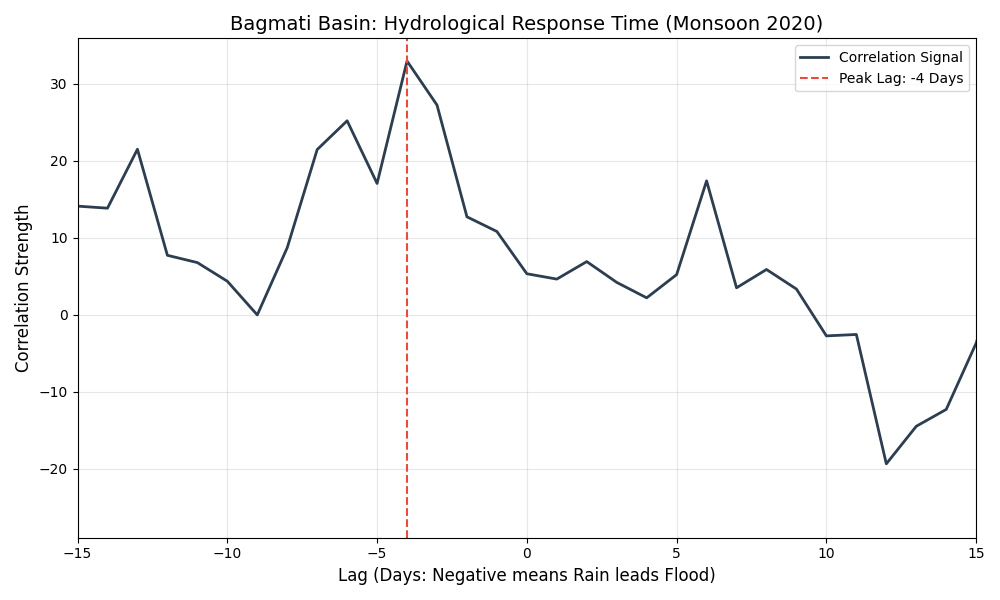 Figure 3: Cross-correlation between rainfall and flood extent. The peak at −4 days indicates that rainfall leads flooding by approximately four days. © 2026 Khem Raj Upreti
This 4-day delay represents the time required for runoff generation in the upper catchment, soil saturation processes, and river flow routing toward downstream areas.
4. Validation: Does This Match Reality?
To validate the results, I compared satellite findings with real-world observations and time-series data.
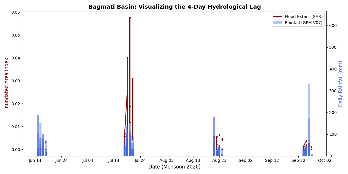 Figure 4A: Rainfall (blue) vs. flood extent (red). Rainfall peaks consistently precede increases in inundation area. © 2026 Khem Raj Upreti
Ground-Truth Verification
Reports from The Himalayan Times confirm that extreme rainfall triggered widespread flooding exactly within the window identified by this analysis.
“Most parts of Rautahat submerged”
“Continuous rainfall since Sunday night has submerged most parts of the district… The Bagmati and Lal Bakaiya rivers have crossed the danger mark, inundating dozens of villages.”
— The Himalayan Times, July 21, 2020
This external report aligns with the July 20–22 peak rainfall intensity captured by GPM and the subsequent inundation captured by SAR imagery.
Visual Flood Evidence
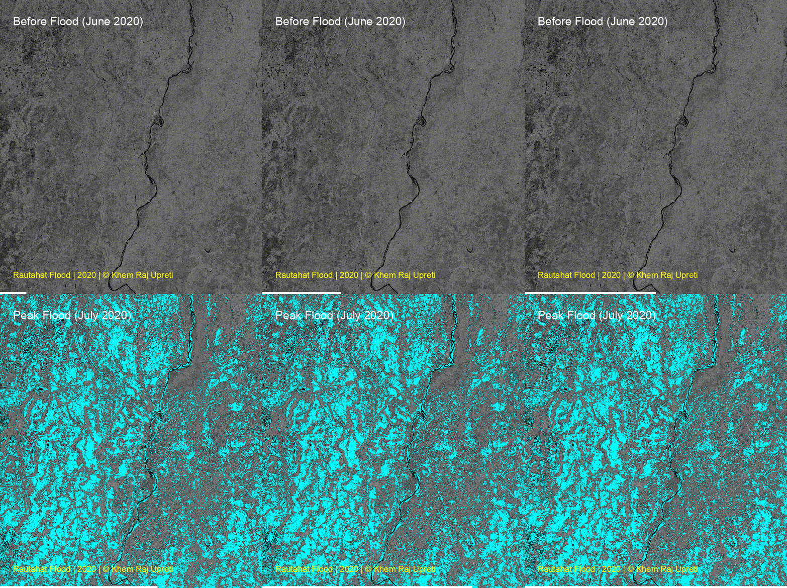 Figure 4B: Sentinel-1 SAR imagery showing flood expansion from pre-flood conditions (June) to peak inundation (July). © 2026 Khem Raj Upreti
5. Key Finding: A 4-Day Early Warning Window
By combining satellite rainfall (GPM) and flood observations (SAR), this study identifies a consistent lead time that can be used for:
- Advance Warning: Providing critical preparation time for downstream communities.
- Emergency Response: Better planning for resource allocation during monsoon extremes.
Conclusion
This study demonstrates a complete flood event chain: Extreme Rainfall → Basin Response → Flood Inundation. The agreement between satellite data and real-world reports provides strong confidence in using integrated approaches to bridge the gap between data scarcity and decision-making in complex Himalayan terrains.
© 2026 Khem Raj Upreti
Recommended citation: Upreti, K. R. (2026). "Validating the July 2020 Bagmati Flood: Linking Rainfall to Inundation Using Satellite Data." Technical Research Note.
Download Paper