
Kankai River Morphodynamics Analysis
In this project, I analyzed the morphodynamics of the Kankai River using the Scientific Python Stack and Google Earth Engine (GEE).
Project Overview
The Kankai River in the Terai region of Nepal is known for significant lateral migration. By leveraging the GEE Python API, I processed multi-temporal satellite imagery to track how the river channel has moved over the last five years.
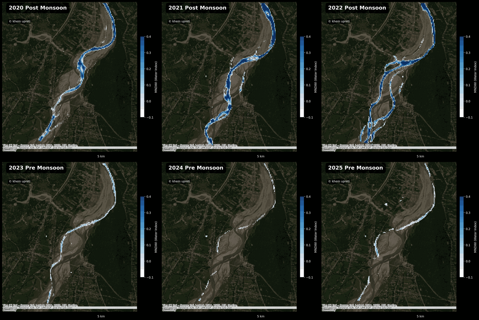
The animation above shows the pre- and post-monsoon channel changes and bank erosion detected via satellite imagery.
Technical Focus:
- Data Sources: Sentinel-2 and Landsat 8/9 Top of Atmosphere (TOA) imagery.
- Processing: Automated cloud masking and NDWI (Normalized Difference Water Index) calculation to isolate water pixels.
- Visualization: Generation of time-lapse GIF animations to quantify river migration rates.
This type of analysis is vital for identifying communities at risk of bank erosion and informing local disaster risk reduction strategies.